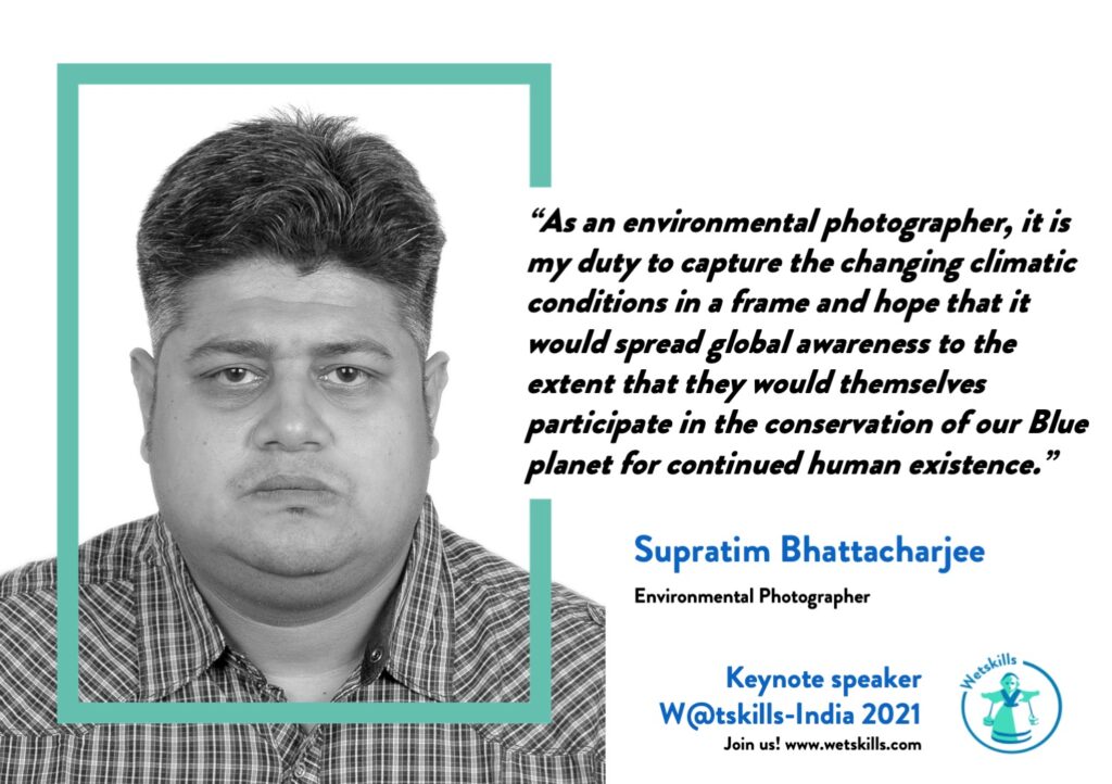
One of the keynote speakers during W@tskills-India 2021 was Environmental Photographer and Story-teller Supratim Bhattacharjee from India. He spoke about his projects The Curse of Coal and Sinking Sundarban and his experiences on Climate Change and Adaptation in India. All cases of W@tskills-India 2021 had a link to the pictures of Supratim. After his keynote Supratim was enthusiastic to continue the cooperation and become Ambassador of our programme. Go to his website and go through his confronting and real-life pictures.
Short BIO
Supratim Bhattacharjee was born in Baruipur near Kolkata. Socio-economic crisis, environmental issues form a part of his interest since his school days. After completing graduation he started working in film production houses of Mumbai holding the post of production professional for 5 years. Later he left his job for concentrated on creating photo stories of the socio-economic crisis, human rights and environmental issues of the subcontinent and bring them in front of the global audience. Currently, for his projects, he has to make frequent visits to Bangladesh, Nepal and several parts of India as he is a long term in-depth visual storyteller whose projects have been appreciated globally. Further, he has plans to represent the gruesome realities of human life in the South Asian Countries with utmost honesty, maintaining the dignity of the human race.
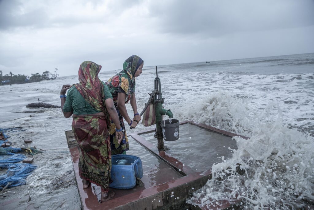
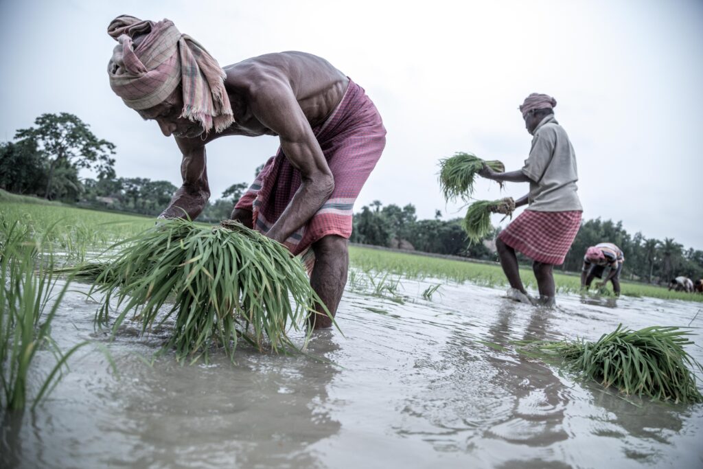
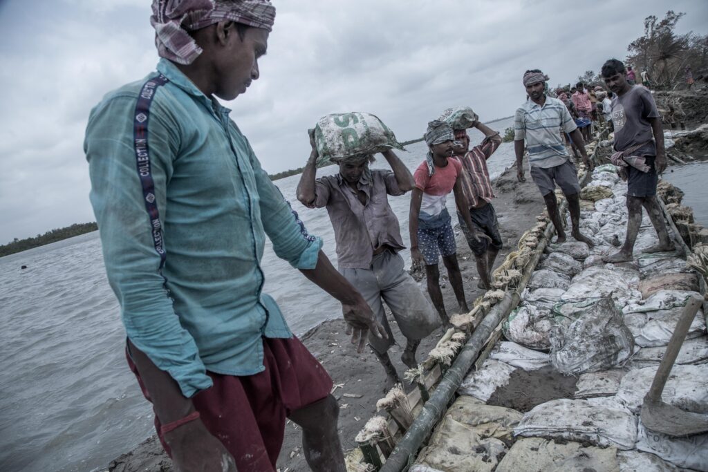
August 1, 2019 : A woman is collecting drinking water from a tube well in the time of tidal flood on Mousuni Island.The southern part of Ganga-Brahmaputra-Meghna delta is a common ground between India and Bangladesh. The Indian delta region stretches around 4000 sq.km approximately. It is covered with the biggest mangrove forest in the world containing 102 swampy islands, out of which only 52 are inhabited by humans. The people here largely depend on the natural resources of the area for their means of livelihood. Global warming is the prime threat to this region. One of the major reasons for this environmental emergency is deforestation. The illiterate, poor and ignorant islanders have vividly cut down bigger trees to collect wood for fuel. They also consider the wood for selling as it is a rich forest product with “Sundari” trees providing the finest variety of wood. Thus, the forest which earlier served as a buffer ground between the wild side of nature and life now has made the soil susceptible to water attacks. As the terror of the environment continues to rage in the form of devastating floods, intense storms, and torrential rains, this land is getting more prone to disaster. The increase in the level of erosion has added to the situation. Sundarbans is seeing 3.14 mm rise in sea levels every year. As the rise in sea levels increases, the salinity in water degrades soil quality causing reduced crop yield and food crisis. Drinking water is also getting increasing obscure here. Additionally, water has already devoured parts of Mousuni and Ghoramara Island. Predictions are saying that a large portion of Sundarbans’ island will get submerged in the coming years.July 15, 2015 : Rice seeds are being sown in Sajtelia of Sundarbans. Delayed rains and repeated cyclones have reduced agricultural opportunities on the island.The southern part of Ganga-Brahmaputra-Meghna delta is a common ground between India and Bangladesh. The Indian delta region stretches around 4000 sq.km approximately. It is covered with the biggest mangrove forest in the world containing 102 swampy islands, out of which only 52 are inhabited by humans. The people here largely depend on the natural resources of the area for their means of livelihood. Global warming is the prime threat to this region. One of the major reasons for this environmental emergency is deforestation. The illiterate, poor and ignorant islanders have vividly cut down bigger trees to collect wood for fuel. They also consider the wood for selling as it is a rich forest product with “Sundari” trees providing the finest variety of wood. Thus, the forest which earlier served as a buffer ground between the wild side of nature and life now has made the soil susceptible to water attacks. As the terror of the environment continues to rage in the form of devastating floods, intense storms, and torrential rains, this land is getting more prone to disaster. The increase in the level of erosion has added to the situation. Sundarbans is seeing 3.14 mm rise in sea levels every year. As the rise in sea levels increases, the salinity in water degrades soil quality causing reduced crop yield and food crisis. Drinking water is also getting increasing obscure here. Additionally, water has already devoured parts of Mousuni and Ghoramara Island. Predictions are saying that a large portion of Sundarbans’ island will get submerged in the coming years.August 18, 2020 : Tidal waves on Namkhana Island have flooded a house. This house was later on found damaged due to the violent waves lashing against its walls.The southern part of Ganga-Brahmaputra-Meghna delta is a common ground between India and Bangladesh. The Indian delta region stretches around 4000 sq.km approximately. It is covered with the biggest mangrove forest in the world containing 102 swampy islands, out of which only 52 are inhabited by humans. The people here largely depend on the natural resources of the area for their means of livelihood. Global warming is the prime threat to this region. One of the major reasons for this environmental emergency is deforestation. The illiterate, poor and ignorant islanders have vividly cut down bigger trees to collect wood for fuel. They also consider the wood for selling as it is a rich forest product with “Sundari” trees providing the finest variety of wood. Thus, the forest which earlier served as a buffer ground between the wild side of nature and life now has made the soil susceptible to water attacks. As the terror of the environment continues to rage in the form of devastating floods, intense storms, and torrential rains, this land is getting more prone to disaster. The increase in the level of erosion has added to the situation. Sundarbans is seeing 3.14 mm rise in sea levels every year. As the rise in sea levels increases, the salinity in water degrades soil quality causing reduced crop yield and food crisis. Drinking water is also getting increasing obscure here. Additionally, water has already devoured parts of Mousuni and Ghoramara Island. Predictions are saying that a large portion of Sundarbans’ island will get submerged in the coming years.May 26, 2020 : Villagers work hard to repair the river embankments of Sundarbans Haldergheri village after the cyclone Amphan wreaked havoc and damaged the embankment.The southern part of Ganga-Brahmaputra-Meghna delta is a common ground between India and Bangladesh. The Indian delta region stretches around 4000 sq.km approximately. It is covered with the biggest mangrove forest in the world containing 102 swampy islands, out of which only 52 are inhabited by humans. The people here largely depend on the natural resources of the area for their means of livelihood. Global warming is the prime threat to this region. One of the major reasons for this environmental emergency is deforestation. The illiterate, poor and ignorant islanders have vividly cut down bigger trees to collect wood for fuel. They also consider the wood for selling as it is a rich forest product with “Sundari” trees providing the finest variety of wood. Thus, the forest which earlier served as a buffer ground between the wild side of nature and life now has made the soil susceptible to water attacks. As the terror of the environment continues to rage in the form of devastating floods, intense storms, and torrential rains, this land is getting more prone to disaster. The increase in the level of erosion has added to the situation. Sundarbans is seeing 3.14 mm rise in sea levels every year. As the rise in sea levels increases, the salinity in water degrades soil quality causing reduced crop yield and food crisis. Drinking water is also getting increasing obscure here. Additionally, water has already devoured parts of Mousuni and Ghoramara Island. Predictions are saying that a large portion of Sundarbans’ island will get submerged in the coming years.
We use cookies to ensure that we give you the best experience on our website. If you continue to use this site we will assume that you are happy with it.